Local guidesSouth San DiegoSan Ysidro
San Ysidro
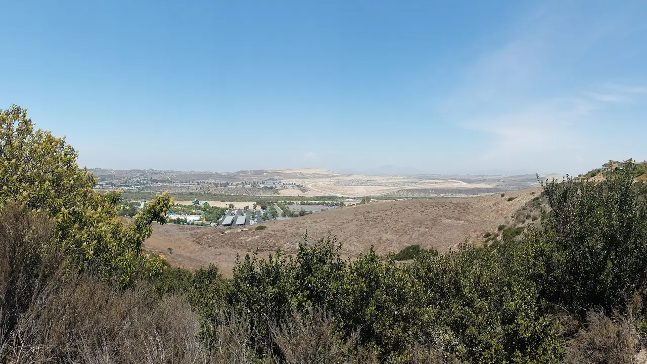
San Ysidro is a neighborhood of the City of San Diego, California, directly north of the Mexico-United States border.
Where is San Ysidro, and what is it like?
San Ysidro is a district of the City of San Diego, directly north of the border with Mexico. Its ZIP code is 92173. It borders Otay Mesa West to the north, Otay Mesa to the east, and Nestor and the Tijuana River Valley to the west. Together with those neighbors it forms South San Diego, a part of the city that is separated from the main body of San Diego.
In the 2010 census, 93 percent of residents were Hispanic. Of residents over age 5, 60 percent spoke Spanish and English well or very well, 13 percent spoke only Spanish and 10 percent spoke only English.
The main streets are Beyer Boulevard and San Ysidro Boulevard. The name is Californio Spanish for St. Isidore.
How did San Ysidro begin?
In 1829 Mexico granted Santiago Argüello Moraga the 10,000-acre Rancho Tía Juana. His son Emigdio received the next-door Rancho Melijo in 1833. Their adobe house, called La Punta, was one of very few buildings in the area until the late 1800s.
Mexico gave up the land after the Mexican-American War. The border was marked in the mid-1860s, the first customs building went up in 1873, and a fence was built in 1910 from the Pacific Ocean to Otay Mountain. In 1887 two developers, Hart and Stern, laid out Tia Juana City on the site of today's Las Americas Premium Outlets. Floods in 1891 and 1895 damaged it.
From 1908 to 1916 the area was home to the Little Landers, a cooperative colony founded by William Ellsworth Smythe. Plots averaged about 2 acres. A major flood destroyed its farms in 1916. Smythe named the settlement San Ysidro, and the George Belcher homestead is the oldest building still standing there.
How did San Ysidro grow?
In the 1920s, Tijuana's racetrack and gambling industry drew American workers who lived in San Ysidro. A modest building boom followed. The San Ysidro Free Public Library opened in 1924 on land donated by Frank Beyer, along with the San Ysidro Community Church. In 1925 the San Ysidro Bank and the Civic and Recreation Center opened. The historic customs building went up in 1931.
After World War II, housing shortages led to new houses, apartment buildings and bungalow courts. The City of San Diego annexed San Ysidro in 1957. The U.S. Inspection Station and Custom House is on the National Register of Historic Places.
What is the San Ysidro border crossing?
The San Ysidro Port of Entry is the fourth-busiest land border crossing in the world. In 2019, more than 15 million vehicles and 36.7 million people entered the United States there. A second pedestrian crossing, PedWest, opened in 2016.
A major expansion was completed in 2019. It cost $741 million, was built in three parts and shifted Interstate 5 to the west. Trucks cannot use this crossing and must use the Otay Mesa Port of Entry.
How do people get around San Ysidro?
The Blue Line of the San Diego Trolley runs to the border. State Route 905, Interstate 5 and Interstate 805 all pass through the area. San Ysidro Boulevard and Beyer Boulevard are the main local streets.
What schools and services are in San Ysidro?
The San Ysidro School District serves kindergarten through eighth grade. The Sweetwater Union High School District runs San Ysidro High School, and the San Ysidro Adult Education Center is also in the community. Parts of San Ysidro are zoned to Southwest Senior High, and a small section to Montgomery High.
The San Diego Public Library runs the San Ysidro Branch. Fire Station 29 is at 179 West San Ysidro Boulevard.
What parks are in San Ysidro?
San Ysidro has Howard Lane Park, Vista Terrace Park and San Ysidro Community Park. The Tijuana River Valley lies to the west, and the Tijuana River Reserve nearby covers 2,500 acres and is surrounded by Tijuana, Imperial Beach and San Diego.
What is the weather like in San Ysidro?
San Ysidro averages 12.09 inches (307 mm) of rain a year, with January the wettest month at 2.56 inches and July the driest at 0.03 inches. The record high is 112 F (44 C), set in June. The record low is 22 F (minus 6 C), reached in January and December.
Find a local business in San Ysidro
San Ysidro is covered by the South San Diego guide. Start with the businesses in San Ysidro itself, or look across the whole guide by what they do.
Businesses in San YsidroQuestions about San Ysidro
- Is San Ysidro part of San Diego?
- Yes. San Ysidro was annexed by the City of San Diego in 1957. It is in the southern part of the city, directly north of the border with Mexico.
- Who founded San Ysidro?
- The Little Landers, a cooperative colony founded by William Ellsworth Smythe, settled the area from 1908. Smythe named the settlement San Ysidro.
- Can trucks use the San Ysidro border crossing?
- No. Trucks must use the Otay Mesa Port of Entry, which is the other crossing inside the City of San Diego.
- Does the trolley go to San Ysidro?
- Yes. The Blue Line of the San Diego Trolley runs to the border at San Ysidro.
- Is there a local business directory for San Ysidro?
- Yes. San Ysidro is covered by the South San Diego guide from Local Business America. It lists local businesses in San Ysidro and the towns around it, and it is free to read.
- How do I list my business in San Ysidro?
- Open the South San Diego guide and choose Claim your listing. If your business is not there yet, choose List your business. Claiming is free, and a person checks each claim.
- What does a business listing in San Ysidro cost?
- Every business has a free listing with opening hours, a map and a link to your website. Essentials is $19 a month and adds a photo gallery, an enquiry form and your Google reviews. Premium is $39 a month and adds a boost to the top of your category and a do-follow link to your website.