Local guidesSouth San DiegoOtay Mesa
Otay Mesa
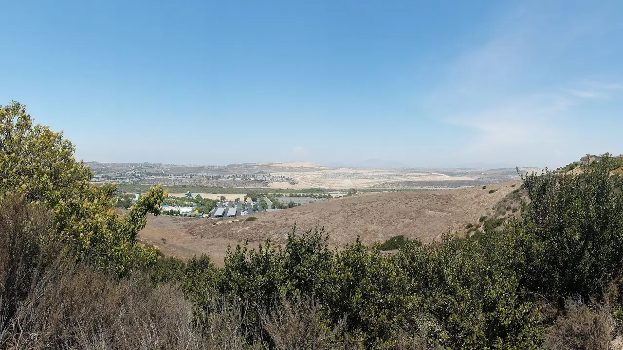
Otay Mesa is a neighborhood in the southern part of the City of San Diego, California, on the U.S.-Mexico border, and the home of one of the city's two border crossings.
Where is Otay Mesa, and what is it like?
Otay Mesa is a neighborhood within the City of San Diego, California. It sits in the southern section of the city, which is cut off from the rest of San Diego by Chula Vista and other communities. The U.S.-Mexico border forms its southern edge. Across the border is the Otay Centenario borough of Tijuana.
To the north are the Otay River Valley and the city of Chula Vista. Interstate 805 marks the western side, with the Ocean View Hills and San Ysidro neighborhoods beyond it. Unincorporated San Diego County lies to the east. The neighborhood is in San Diego City Council District 8.
The city's community plan for Otay Mesa was adopted on March 11, 2014. It treats the area as a major employment center and describes two residential village areas. It refers to two specific plans, the Otay Mesa Central Village Specific Plan and the Southwest Village Specific Plan. The plan also calls for public trails across the canyons and mesas.
Where does the name Otay Mesa come from?
The word Otay comes from the Kumeyaay language. Its meaning is disputed. Suggested meanings include brushy, big mountain and big. Mesa is Spanish for plateau, table or tableland, which describes the flat, raised ground the neighborhood sits on.
Otay Mesa also has a place in aviation history. In 1883 and 1884, the aviation pioneer John J. Montgomery flew gliders from the west rim of the mesa. These were the first controlled flights in the western hemisphere.
How did Otay Mesa become part of San Diego?
The area was annexed from San Diego County in 1957, along with other parts of South San Diego. At the time, the neighboring Otay Mesa-Nestor planning area had fewer than 1,000 housing units. Residential building sped up sharply by the late 1960s.
Almost 4,000 acres more were approved for annexation in 1985. That added land to the city's southern exclave and set the base for the employment area the community plan describes today.
What is the Otay Mesa border crossing?
The Otay Mesa Port of Entry is one of two border crossings inside the City of San Diego. The other is the San Ysidro Port of Entry, six miles to the west. Trucks are generally directed to Otay Mesa, because the San Ysidro crossing does not take them.
Otay Mesa is also home to Cross Border Xpress, a terminal and pedestrian bridge that leads to Tijuana International Airport. The Otay Mesa terminal covers 45,000 square feet. It was built by Otay-Tijuana Ventures LLC at a cost of $78 million and opened in 2015. The airport's main terminal and runways are in Mexico, while the Cross Border Xpress terminal is on the U.S. side.
What businesses are in Otay Mesa?
The city's community plan describes Otay Mesa as a dynamic area with a focus on employment. Because trucks are generally directed to the Otay Mesa crossing, the neighborhood sits at the center of freight traffic across the border.
The Otay Mesa Energy Center is a natural gas power plant of roughly 600 MW about 1.5 miles north of the border. It has been online since 2009.
How do people get around Otay Mesa?
The main roads are Otay Mesa Road, which is also State Route 905, Otay Valley Road and Heritage Road, Siempre Viva Road and State Route 125. Several highways serve the wider area: Interstate 5, Interstate 805, State Route 11, State Route 905 and the State Route 125 toll road, known as the South Bay Expressway.
Interstate 805 forms the western edge of the community, and State Route 905 links the neighborhood with the freeway system and the border.
What schools and open space serve Otay Mesa?
Otay Mesa is served by the San Ysidro School District for elementary grades and the Sweetwater Union High School District for high school. Elementary schools in and near the neighborhood include Finney, Los Altos, Howard Pence and Silverwing. High school zoning is to Montgomery High School.
The Otay River Valley forms the northern edge of the community. Otay Valley Regional Park is a joint effort of Chula Vista, San Diego and the county.
What is the weather like in Otay Mesa?
Otay Mesa has a semi-arid climate with mild winters and warm, almost rainless summers. Figures from Brown Field Municipal Airport for 1998 to 2020 give an annual mean daily high of 72.5 F (22.5 C) and a mean daily low of 52.7 F (11.5 C).
August is the warmest month, with a mean daily high of 80.6 F (27.0 C). January is the coolest, at 67.0 F (19.4 C). Annual rainfall is 10.23 inches (260 mm). February is the wettest month, with 2.39 inches, and July is the driest, with 0.04 inches.
Find a local business in Otay Mesa
Otay Mesa is covered by the South San Diego guide. Start with the businesses in Otay Mesa itself, or look across the whole guide by what they do.
Businesses in Otay MesaQuestions about Otay Mesa
- Is Otay Mesa part of the City of San Diego?
- Yes. Otay Mesa is a neighborhood within the City of San Diego. It was annexed from San Diego County in 1957, and it lies in the southern section of the city, next to the border.
- What does the name Otay mean?
- The name comes from the Kumeyaay language, and its meaning is disputed. Suggested meanings are brushy, big mountain and big. Mesa is Spanish for plateau or tableland.
- How many border crossings are in the City of San Diego?
- Two. They are the Otay Mesa Port of Entry and the San Ysidro Port of Entry, which is six miles to the west. Trucks are generally directed to Otay Mesa.
- What is Cross Border Xpress?
- It is a terminal and pedestrian bridge in Otay Mesa that connects to Tijuana International Airport. It opened in 2015 and cost $78 million.
- Which school districts serve Otay Mesa?
- The San Ysidro School District serves elementary grades and the Sweetwater Union High School District serves high school. High school zoning is to Montgomery High School.
- Is there a local business directory for Otay Mesa?
- Yes. Otay Mesa is covered by the South San Diego guide from Local Business America. It lists local businesses in Otay Mesa and the towns around it, and it is free to read.
- How do I list my business in Otay Mesa?
- Open the South San Diego guide and choose Claim your listing. If your business is not there yet, choose List your business. Claiming is free, and a person checks each claim.
- What does a business listing in Otay Mesa cost?
- Every business has a free listing with opening hours, a map and a link to your website. Essentials is $19 a month and adds a photo gallery, an enquiry form and your Google reviews. Premium is $39 a month and adds a boost to the top of your category and a do-follow link to your website.