Local guidesSouth Orange CountyLaguna Niguel
Laguna Niguel
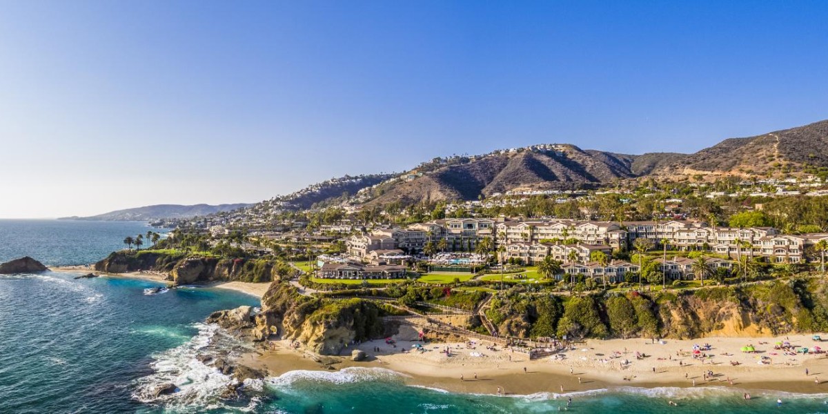
Laguna Niguel is a hilly, mostly residential city of 64,355 people in the San Joaquin Hills of southern Orange County, California, close to the Pacific but not on it.
Where is Laguna Niguel, and what is it like?
Laguna Niguel is in the San Joaquin Hills, in the southeastern corner of Orange County, California. The 2020 census counted 64,355 people. It borders Aliso Viejo, Dana Point, Laguna Beach, Laguna Hills, Mission Viejo and San Juan Capistrano. On the west it runs up against a large stretch of unincorporated land, Aliso and Wood Canyons Wilderness Park.
The city is mostly residential and works as a bedroom community for job centers in north and central Orange County. Most residents commute to places like Irvine and Newport Beach, and most jobs inside the city are in the service industry. Median household income runs 31 percent above the Orange County average. The city is known for a mild coastal climate, a low crime rate, and a large number of parks and public trails.
One oddity: it is very close to the Pacific, yet it does not touch it. That is the result of a fight with Dana Point over the coastline in 1989, covered below.
What are the land and weather like in Laguna Niguel?
The city covers 14.8 square miles of mostly hilly terrain. The average elevation is 400 feet (120 m), and the land runs from near sea level up to 936 feet (285 m) at the summit of Niguel Hill in the southwest corner. Two creeks matter most. Salt Creek flows through the south. Sulphur Creek drains much of the north and feeds into Aliso Creek, which runs through the deep Aliso Canyon to the ocean. Laguna Niguel Lake, formed by damming Sulphur Creek, is the biggest body of water in town.
The weather is pleasant year-round. August is usually the hottest month and December the coolest. The record high was 108 °F (42 °C), set in 1963, and the record low was 21 °F (-6 °C), recorded in 1949. Rain averages 14.2 inches a year, with February the wettest month at 3.4 inches. Only five months a year get more than an inch.
How did Laguna Niguel begin?
The first recorded inhabitants were the Acjachemem, who may have had a village called Niguili near where Aliso Creek meets Sulphur Creek. Aliso Creek marked the boundary between the Acjachemem and the Tongva. The name Laguna Niguel combines "laguna", Spanish for lagoon, with Niguili. The lagoon was a tidal one that once formed at the mouth of Aliso Creek.
Spanish missionaries founded nearby Mission San Juan Capistrano in the 1700s, and the mission lands, which included today's Laguna Niguel, were split into private land grants in 1821 when Mexico became independent. In 1842 the 13,316-acre Rancho Niguel was granted to Juan Avila. He kept it through the Mexican-American War until 1865, when a severe drought drove him into bankruptcy.
In 1895 Lewis Moulton and Jean Pierre Daguerre bought the rancho and surrounding land from struggling farmers. Their Moulton Company oversaw 19,000 acres used mainly for orchards and sheep ranching well into the mid-20th century. The land was divided between the Moulton and Daguerre families in 1951. In 1954 the Daguerres sold 7,200 acres to the Shumaker Group and 856 acres of oceanfront to George Capron, a former Major League Baseball player.
How did Laguna Niguel become a planned community?
The completion of Interstate 5 in 1959 made it easy to reach jobs in Los Angeles County and set off a housing boom. That same year, Cabot, Cabot & Forbes and Paine Webber formed the Laguna Niguel Corporation, which bought the Daguerre land to build one of California's first master-planned communities. Cabot Road and Forbes Road are named for the company. The first town plan covered 7,100 acres and was drawn by Viennese architect Victor Gruen. AVCO Community Developers took over and expanded it starting in 1971.
The plan was meant to let families meet most of their economic, social and cultural needs inside the community, and it set aside nearly a third of the land for parks and open space. The first tracts of Monarch Bay and Niguel Terrace, 565 homes in all, were finished in 1962. The Moulton Niguel Water District formed in 1960 to bring in Colorado River water, since the area lacked enough of its own. Crown Valley Parkway was completed from I-5 to the Pacific Coast Highway in 1964, and the population reached 1,000 by 1965.
Laguna Niguel Regional Park opened in 1973. A local landmark nicknamed the Ziggurat, the Chet Holifield Federal Building, designed by William L. Pereira, was built in 1971 for Rockwell International and was meant to bring 7,000 jobs to the area.
Why does Laguna Niguel have no coastline?
In 1965 the Laguna Niguel Corporation bought George Capron's oceanfront land and began developing the Niguel Shores area, first called the Coastal Strip and today known as Monarch Beach. By the 1970s unincorporated Dana Point wanted those neighborhoods in its own new city. In 1977 Dana Point briefly proposed incorporating together with Laguna Niguel as a single city.
Both places filed incorporation requests in December 1986, and a fight broke out immediately over Monarch Beach. The Laguna Niguel Corporation had built it, but residents voted 61 percent to join Dana Point. The city was formally incorporated on December 1, 1989, without the coastal strip, as Orange County's 29th city.
Population climbed from 12,237 in 1980 to 61,891 in 2000, then slowed because the city was fully built out. Alicia Parkway reached I-5 in 1992, and the San Joaquin Hills toll road opened in 1996. The new City Hall, planned as early as 1989, opened on October 15, 2011.
What disasters has Laguna Niguel faced?
Residents noticed damage to retaining walls and roads near an artificial slope on Via Estoril in the Niguel Summit community in 1994, and geologists warned of a possible landslide. After heavy rain from the 1997-98 Super El Niño, the hill collapsed on March 19, 1998. It destroyed 5 or 6 homes at the top and five condominium units at the bottom. Nobody died because the area had been evacuated only hours before.
An investigation found the developer, J.M. Peters Inc., had improperly packed and graded the 275,000 tons of fill under the homes. The most recent blow to the same subdivision was a coastal fire in 2022 that flattened 20 homes and damaged many more.
What are the neighborhoods and parks of Laguna Niguel?
Street patterns follow the hills, so there is no grid. Neighborhoods include Bear Brand Ranch, San Marin, El Niguel Heights, Ocean Ranch, Laguna Crest, Laguna Sur, Coronado Pointe, South Peak, Niguel Coast, Palmilla, Beacon Hill, Monarch Point, Rancho Niguel, Marina Hills, Niguel West, Niguel Summit, Kite Hill and Rolling Hills, among others. Some of them have city, canyon and ocean views.
Parks are the city's best-known feature. Over one-third of Laguna Niguel is public open space, divided between 31 city parks and 4 county parks. The 227-acre Laguna Niguel Regional Park has trails, ball courts and the lake, a popular spot for fishing and boating. Crown Valley Park draws about 240,000 people a year and holds the main public sports facilities. Aliso and Wood Canyons Wilderness Park, over 4,000 acres, is part of the larger South Coast Wilderness of 22,000 acres of preserved open space.
There are about 80 miles of non-motorized trails for hiking, biking and horseback riding. Highlights include the Aliso Summit trail along the rim of Aliso Canyon, the Colinas Bluff Trail overlooking San Juan Capistrano, and the Laguna Ridge Trail through Badlands County Park. The paved Salt Creek Trail follows the creek from Dana Point to the regional park. The city also has about 60 miles of bike lanes, and the Niguel Botanical Preserve is a free garden beside the Crown Valley Community Center.
How do you get around Laguna Niguel?
Interstate 5 runs along the northeastern border with Mission Viejo, with interchanges at Avery Parkway and Crown Valley Parkway. The State Route 73 toll road runs along the northern edge and gives a paid alternative to the busy Interstate 405. The Pacific Coast Highway lies just outside the southern boundary. Crown Valley Parkway cuts across the city from southwest to northeast, linking the PCH in Dana Point to I-5 in Mission Viejo. Alicia Parkway, Niguel Road and La Paz Road are other main routes.
The Laguna Niguel/Mission Viejo Metrolink station, off Forbes Road near I-5, has Orange County Line and Inland Empire-Orange County Line service. Amtrak's Pacific Surfliner stopped here from 2007 to 2012, and now stops at nearby Irvine and San Juan Capistrano. OCTA runs buses on routes 85, 87, 90, 91, 187 and 490, and the 490 connects to the train station. The nearest airport is John Wayne, 15 miles away. A car is a must.
What schools and services does Laguna Niguel have?
The Capistrano Unified School District runs the public schools. Elementary schools include Moulton, Crown Valley, Hidden Hills, Laguna Niguel and others, and Niguel Hills Middle School serves older students. High schoolers go to Aliso Niguel High School in Aliso Viejo or Dana Hills High School in Dana Point. Saddleback College in Mission Viejo is the nearest community college.
The Orange County Fire Authority handles fire protection and the Orange County Sheriff provides police. There is no hospital in the city, but Mission Hospital, Saddleback Memorial Hospital and South Coast Medical Center are nearby. City Hall is at 30111 Crown Valley Parkway, and the five-member City Council is elected at large.
Find a local business in Laguna Niguel
Laguna Niguel is covered by the South Orange County guide. Start with the businesses in Laguna Niguel itself, or look across the whole guide by what they do.
Businesses in Laguna NiguelQuestions about Laguna Niguel
- How many people live in Laguna Niguel?
- The 2020 census counted 64,355 people. The 2010 census counted 62,979.
- Is Laguna Niguel on the ocean?
- No. It is close to the Pacific but does not border it, because the coastal Monarch Beach area went to Dana Point when the cities incorporated.
- When was Laguna Niguel incorporated?
- It was formally incorporated on December 1, 1989, as Orange County's 29th city.
- Is there a train station in Laguna Niguel?
- Yes. The Laguna Niguel/Mission Viejo Metrolink station at 28200 Forbes Road is served by the Orange County Line and the Inland Empire-Orange County Line.
- What school district is Laguna Niguel in?
- The Capistrano Unified School District serves the city.