Local guidesSan DiegoDowntown and Gaslamp
Downtown and Gaslamp
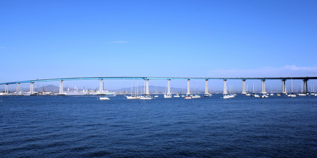
Downtown is the central business district of San Diego, sitting on San Diego Bay, and the Gaslamp Quarter is its historic nightlife district of Victorian-era buildings.
Where is Downtown San Diego, and what is it like?
Downtown San Diego is the central business district of the city, which is the eighth largest in the United States. It holds the major local headquarters of the city, county, state and federal governments. The area is made up of eight neighborhoods: Gaslamp Quarter, East Village, Columbia, Marina, Cortez Hill, Little Italy, Bankers Hill and Core.
San Diego Bay forms its western and southwestern edge. To the north are Bankers Hill, Middletown and Balboa Park. Sherman Heights and Golden Hill lie to the east, and Barrio Logan and Logan Heights to the southeast. San Diego International Airport is three miles (4.8 km) to the northwest.
That closeness has a rule attached. Because of the airport, the FAA limits every building within a 2.3-mile radius of the runway to 500 feet. The limit exists so that nothing taller than that gets in the way of aircraft on approach. It is a big part of why downtown reads as a field of mid-sized towers and not a wall of skyscrapers.
How did Downtown San Diego begin?
The Kumeyaay lived here first. They called the area Tisirr and had a village called Pu-Shuyi near what is now Seaport Village. The Spanish-era city grew up around Old Town and the Presidio, several miles north, and that spot had a flaw: it was several miles from navigable water.
In 1849, a surveyor named Lt. Andrew B. Gray suggested that a site nearer the bay would be better for trade. He took the idea to William Heath Davis, who recruited four other investors. Under his lead the partners bought 160 acres (65 ha), laid out streets for a place they called New Town, and built a wharf and a warehouse. The William Heath Davis House from that period is still standing and is now a museum.
New Town struggled. It had no fresh water, a financial depression arrived in 1851, and the established settlements in Old Town and La Playa opposed it. In 1852 a San Diego grand jury called for Kumeyaay villages near any White settlement to be removed, and the village of Tisirr was razed to the ground.
Then came Alonzo Horton. In 1867 he bought 800 acres (320 ha) of pueblo land, and in 1869 he added Davis's 160 acres to his holdings. Davis's wharf had fallen to pieces by then, so Horton built a new one at the end of Fifth Avenue. He sold lots hard and gave some land away, which set off the first of San Diego's many real estate booms. County records moved to a new courthouse in New Town in 1871, and by the 1880s the new district had totally eclipsed Old Town as the heart of the growing city.
How did Downtown become what it is today?
The transcontinental railroad reached San Diego in 1885. The Santa Fe railway station opened downtown in 1887, and in 1915 it was replaced by the Santa Fe Depot, which is still in use. In 1886 New Town got its first electric lights and first streetcars. The Spreckels Theatre opened in 1912 as the first modern commercial playhouse west of the Mississippi, and the city built the Broadway Pier in 1913. Streetcars built by John D. Spreckels ran through downtown until 1939.
The middle of the last century was rough. In the 1960s, major businesses and stores moved to suburban malls. Downtown became known as a hangout for homeless people and sailors on liberty, and tattoo parlors, bars and strip clubs were the main kinds of business. Many Victorian houses were run down. The tallest building was only fourteen stories. City Hall and the Community Concourse were dedicated in 1964 at 202 C Street, and the city has discussed a replacement since, though no plan has been approved.
Redevelopment plans were drawn up in 1975, driven in part by councilman Leon Williams, who represented downtown at the time. By 1985 the Gaslamp Quarter revival, Horton Plaza and the San Diego Convention Center were complete. Petco Park, home of the San Diego Padres, opened in 2004. As of 2026, the Horton Plaza mall itself sits abandoned.
Chinatown is part of the story too. The first Chinese residents arrived in the 1860s, and by the 1870s they were the area's main fishermen. At its peak about a thousand Chinese lived in San Diego, and they faced discrimination. Filipinos began settling in and near Chinatown in the early 1900s. The neighborhood lasted until World War II, and in 1995 the Asian Pacific Thematic Historic District was created to protect the buildings that remain.
What is the Gaslamp Quarter?
The Gaslamp Quarter is a historic district running from Broadway to Harbor Drive and from 4th to 6th Avenue, roughly two blocks wide by ten blocks long. It is listed on the National Register of Historic Places and includes over 90 historic buildings, most from the Victorian era. Many are now restaurants, shops, entertainment venues and nightclubs. Fifth Avenue was Horton's chosen main street. Among the old buildings are the Louis Bank of Commerce, the Backesto Building, the Old City Hall and the Yuma Building.
The district has had several lives. From the 1880s to 1916 it was a working class area called the Stingaree, home to San Diego's first Chinatown, plus saloons, gambling halls and bordellos. In 1912 a free speech fight there between socialists and city politicians led to riots, and vigilantes abducted Emma Goldman's husband. In 1916 anti-vice campaigners demolished the whole Stingaree and renamed it.
From the 1950s through the 1970s the decaying quarter was a sailors' entertainment district. Interest in saving the buildings began in 1970. The city adopted a design and development manual in 1976, made the quarter the major focus of downtown redevelopment in 1982, and dedicated the Gaslamp Quarter Archway in 1992. The name came during that revival, though the old streets were generally lit by arc lights, not gaslamps.
Today the quarter is known for nightlife and for events such as Mardi Gras in the Gaslamp, Taste of Gaslamp and ShamROCK, a St. Patrick's Day event. Petco Park is one block away in East Village. The Gaslamp Museum, in the Davis Horton House on Island Avenue, is the headquarters of the Gaslamp Quarter Historical Foundation and starts guided walking tours. Crowded clubs have a downside: pickpocketing is common in the district.
How is Downtown San Diego laid out?
Streets run in a grid, and many are one way. North and south, the named streets start at Harbor Drive and run east past Pacific Highway, Kettner Boulevard, India, Columbia, State, Union and Front streets. After that come numbered avenues, from 1st Avenue to Park Boulevard (12th Avenue). East and west, streets go alphabetically from A to K, except that D, H and I are replaced by Broadway, Market Street and Island Avenue. North of A Street the streets are named for trees, from Ash up to Laurel. Broadway and Market Street are the main east-west roads, and Harbor Drive, Pacific Highway and Park Avenue the main north-south ones.
Each of the eight districts has its own feel. Columbia, on the west side, runs along Broadway toward the harbor. It is mostly commercial, holds most of the city's tallest buildings and the train depot, and has a large piece of the waterfront. Core is the commercial and government center, next to the shopping district around Horton Plaza. Cortez Hill, on the north side, is mostly residential and sits against Interstate 5.
Little Italy, at the northwest end, was home to Italian fishermen and is now a busy district of shops, restaurants and parks. Marina, in the southwest, has marinas, high-rise condos, hotels, the Convention Center and Seaport Village. East Village, to the southeast, is in a building and redevelopment boom that the ballpark helped start. The gap between the ends is real: it is a long walk from Little Italy to Petco Park.
What is Downtown San Diego known for?
The waterfront has the most famous landmarks. The USS Midway Museum is an aircraft carrier turned museum ship. The Maritime Museum of San Diego keeps eight ships and boats, led by the Star of India, the world's oldest active sailing ship, and the Berkeley, a steam ferryboat from 1898. More than 200 cruise ships a year call at the cruise ship terminal, and a passenger ferry crosses to Coronado. The Convention Center and Seaport Village sit nearby.
For the arts, the San Diego Civic Theatre is home to the San Diego Opera. The San Diego Symphony is based at Jacobs Music Center, a renovated movie palace on 7th Avenue built in 1929 as the Fox Theater. The Spreckels Theatre has run continuously since 1912, and the Balboa Theatre, built in 1924, reopened in 2008 after major renovation. Both are on the National Register of Historic Places. The Museum of Contemporary Art has shown work in many media since 1950, and the Rady Shell at Jacobs Park is an outdoor stage.
Petco Park has a nice quirk. A historic warehouse, the Western Metal Supply Co. building, is built into the left-field seats, and the grassy Park at the Park beyond the outfield wall is open to the public on days without a Padres home game. A statue of Tony Gwynn stands nearby. The Santa Fe Depot, the Mission-style station that opened in 1915, is worth a look even if no one is catching a train.
Downtown's calendar is packed. Every mid to late July the San Diego Convention Center hosts San Diego Comic-Con, the largest entertainment and comic book convention in the world, which spills into nearby hotels, parks and plazas. Other annual events include the Big Bay Balloon Parade held with the Holiday Bowl, the Martin Luther King Jr. Day Parade and Festival, the Parade of Lights on the bay each December, the Street Scene music festival, and the Festival of Sail on Labor Day weekend, when tall ships come to the waterfront. Movies like Demolition Man and Traffic were filmed here.
Who works and learns in Downtown San Diego?
Government is the base. City Hall and other city offices, the San Diego Police Headquarters at 14th and Broadway, a California state office building at 1350 Front Street and a three-block federal office complex at 8th and Front streets are all here, along with county and federal courthouses. Tourism and conventions are the other big engine, fed by the cruise terminal, the bay hotels and the Convention Center.
A new nine-story Central Library opened in 2013 on Park Boulevard at J Street. The charter high school e3 Civic High School is inside it. The downtown area is served by San Diego Unified School District. Washington Elementary School is downtown, and middle school students attend Roosevelt Middle School near Balboa Park. San Diego High School and San Diego City College sit in the northeastern corner next to the park. Monarch School, a public K-12 school for students who are homeless or affected by homelessness, is also downtown, as is California Western School of Law.
How do you get around Downtown San Diego?
Three freeways reach downtown. State Route 163 ends here, with its southbound lanes becoming 10th Avenue and the northbound lanes starting from 11th Avenue at Ash Street. Interstate 5 passes over the area and wraps around the north and west. State Route 94 comes in from the east, with westbound lanes becoming F Street and G Street becoming eastbound. Parking is mostly pay lots and metered street spaces, and it is expensive and hard to find on event days such as Padres games.
Rail is strong. The Santa Fe Depot at Broadway and Kettner is the southern end of the COASTER commuter train, which runs north along the coast to Oceanside, and it is also an Amtrak stop for the Pacific Surfliner to Los Angeles. All three San Diego Trolley lines serve downtown. The Blue Line comes from the border at San Ysidro and the Orange Line from El Cajon and La Mesa, both along Park Boulevard and C Street. The Green Line comes down from Mission Valley and Old Town through Little Italy and then runs along Harbor Drive past the Convention Center and Petco Park. Nearly all bus routes serving downtown cross Broadway at some point, and the 12th and Imperial Transit Center in the southeast is also the Greyhound station.
Downtown is dense enough to walk. A few spots along Harbor Drive can feel risky because of heavy traffic, but walking is generally safe, even at night.
Find a local business in Downtown and Gaslamp
Downtown and Gaslamp is covered by the San Diego guide. Start with the businesses in Downtown and Gaslamp itself, or look across the whole guide by what they do.
Businesses in Downtown and GaslampQuestions about Downtown and Gaslamp
- What neighborhoods are in Downtown San Diego?
- Eight: Gaslamp Quarter, East Village, Columbia, Marina, Cortez Hill, Little Italy, Bankers Hill and Core.
- Why is it called the Gaslamp Quarter?
- The name was adopted during the revival and preservation work of the 1980s. The streets were generally lit by arc lights, not gaslamps.
- How far is the airport from Downtown San Diego?
- San Diego International Airport is three miles (4.8 km) northwest of downtown. Buildings within a 2.3-mile radius of its runway are limited to 500 feet.
- When is San Diego Comic-Con held?
- Every mid to late July, inside the San Diego Convention Center, with nearby hotels, parks and plazas as supporting venues.
- How big is the Gaslamp Quarter?
- It runs from Broadway to Harbor Drive and from 4th to 6th Avenue, about two by ten blocks, and includes over 90 historic buildings.