Local guidesPark City & Summit CountyKamas
Kamas
Kamas is a small city in southwestern Summit County, Utah, 42 miles (68 km) east of downtown Salt Lake City, with 2,092 residents at the 2020 census.
Where is Kamas, and what is it like?
Kamas calls itself The Gateway to the Uinta Mountains. It sits in southwestern Summit County, 42 miles (68 km) east of downtown Salt Lake City, and covers 1.6 square miles (4.1 km2). Its main industries are cattle ranching and lumber. The 2020 census counted 2,092 people, all of them living in rural areas, and the median age was 35.2. In 2020, 43.5% of households had children under 18.
The climate is warm-summer humid continental. The hottest temperature recorded was 101 degrees Fahrenheit (38.3 C) on July 13, 2002, and the coldest was minus 31 degrees Fahrenheit (minus 35.0 C) on December 21, 1990.
How did Kamas begin?
The name comes from Camassia quamash, a flowering plant that grows in the region and was a food source for Native Americans. Several groups lived in the valley on and off, including the Ute, Shoshone and Snake tribes. The first permanent settlers are believed to be Mormon pioneers Abraham Marchant, John Lambert and John Pack, who settled under the direction of Brigham Young.
The best-known local legend is about Thomas Rhoads. According to the story, Ute guides showed him a gold mine so he could take gold for building the Salt Lake Temple, on the condition that he tell no one where it was. He kept the promise until he died. Records cited by professor Leonard Arrington suggest the Rhoads family did supply a lot of gold to the church, but Arrington was cautious about a real mine. The Rhoads Mine is now considered lost.
How big has Kamas grown?
The 2000 census counted 1,274 people in 445 households, with a median age of 30 and 33.0% of residents under 18. The median household income then was $41,667. By the 2020 census the population was 2,092 in 713 households, so the town grew a good deal over those twenty years.
In 2020, 58.8% of households were married-couple households and about 18.1% were people living alone. The census counted 764 housing units, of which 6.7% were vacant. Most people in town belong to the Church of Jesus Christ of Latter-day Saints, as in most rural Utah towns. Kamas also has a Bible church, and the small Catholic minority mostly attends church in Heber City or Park City.
What is the Mirror Lake Highway?
State Route 150, the Mirror Lake Highway, starts in Kamas at the corner of Main Street (State Route 32) and Center Street and heads east on Center Street as a two-lane road. The legislature designated it in 1933, running from Kamas to the Wasatch-Cache National Forest boundary. In 1953 it was extended past Mirror Lake to the Wyoming state line, south of Evanston. It is a USDA Forest Service Scenic Byway.
At Bald Mountain Pass, at 10,715 feet (3,266 m), it is the highest paved road in Utah. In winter it is closed to cars and used by snowmobiles. It is also the route of the mountain stage of the High Uintas Classic bicycle race. Mirror Lake itself is one of the most popular lakes in the Uintas, known for its fishing, its views and its easy road access.
What are the Uinta Mountains, and what is the national forest?
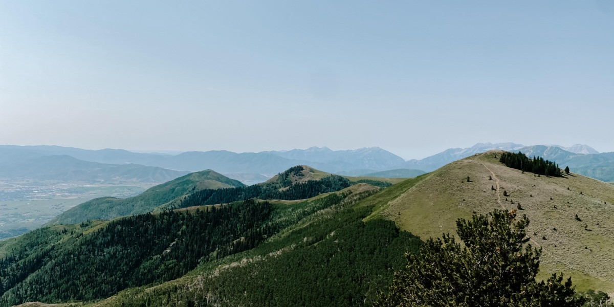
The Uinta Mountains run east to west across northeastern Utah, about 100 miles (160 km) east of Salt Lake City. They are unusual among the Rockies for running that direction, and they are the highest range in the contiguous United States that does. Kings Peak, at 13,528 feet (4,123 m), is the highest point in Utah. The name comes from the Ute word Yoov-we-teuh, meaning pine forest. Between the ridges are broad basins holding around 500 small lakes, and the Weber and Bear rivers are born on the range's west slope.
Most of the range lies in the Uinta-Wasatch-Cache National Forest on the north and west. The highest peaks sit inside the High Uintas Wilderness, which covers 456,705 acres (1,848.22 km2), shared with Ashley National Forest. The wilderness is listed under the Kamas, Evanston and Mountain View districts, and one of the forest's local ranger district offices is in Kamas. The forest's name comes from the Ute word Wasatch, for a low place in high mountains, and the French word Cache, which meant to hide and first referred to fur trappers.
What happens in Kamas?
Kamas is the starting point of the High Uintas Classic, a two-day bicycle race held each summer, usually in mid-June. The mountain stage follows the Mirror Lake Highway from downtown Kamas over Bald Mountain Pass and into Evanston, Wyoming. The Tour of Utah went through downtown in 2012 and again in 2013. Fiesta Days is held on and around July 24, Utah's Pioneer Day, with rodeos, a demolition derby, a parade and a pageant. The High Country Classic wrestling tournament is held every January.
What towns are near Kamas?
Oakley is the closest city, 45 miles (72 km) east of Salt Lake City on State Route 32, in the Kamas Valley. It sits at 6,500 feet (2,000 m) and had 1,588 people in 2020. Its first settlers, William Stevens and his wife Emma Crowden Stevens, arrived in 1868. The town was first called Oak Creek and took the name Oakley in late 1886 or early 1887, and it incorporated in 1933. Its town hall began as a church built in 1903. Weber Canyon Road follows the Weber River up toward its headwaters.
Francis is a town on the western edge of the county. It covers 1.8 square miles (4.7 km2) and counted 1,564 people in 2020. Peoa is an unincorporated community along State Route 32, between Jordanelle and Rockport State Parks and south of Coalville, with 249 people in 2020. It was first settled in 1857 by William W. Phelps and others. Mink farming was once a major industry there. Today its economy includes a large rock quarry, beef cattle and hay.
How do schools and buses work in and around Kamas?
Kamas is in the South Summit School District and hosts its facilities. There is a high school, a middle school and an elementary school, all called South Summit. Students come from Peoa, Oakley, Marion, Francis and Woodland, and from Weber Canyon and Mirror Lake Canyon.
High Valley Transit's route 102 runs to Park City, with three round trips in the morning and three in the afternoon. The agency was created in 2021, provides fare-free service in Summit and Wasatch counties, and also serves Heber. Francis gets the same 102 bus.
How does Kamas fit into Summit County?
These are county figures, not Kamas's own. Summit County had 42,357 people at the 2020 census and covers 1,882 square miles (4,870 km2). Its county seat is Coalville and its largest city is Park City. Its central and eastern portion is mostly the Uinta Mountains, and its western portion runs to the east slopes of the Wasatch Mountains. The county's highest point is Gilbert Peak, at 13,448 feet (4,099 m), on the border with Duchesne County. Three school districts cover parts of the county, and South Summit is the one Kamas hosts.
Find a local business in Kamas
Kamas is covered by the Park City & Summit County guide. Start with the businesses in Kamas itself, or look across the whole guide by what they do.
Businesses in KamasQuestions about Kamas
- How far is Kamas from Salt Lake City?
- Kamas is 42 miles (68 km) east of downtown Salt Lake City.
- How did Kamas get its name?
- It is named for Camassia quamash, a flowering plant that grew in the region and was food for Native Americans.
- Is there a bus from Kamas to Park City?
- Yes. High Valley Transit's route 102 runs to Park City, with three round trips in the morning and three in the afternoon.
- Where does the Mirror Lake Highway start?
- It starts in Kamas at Main Street (State Route 32) and Center Street, then climbs east over Bald Mountain Pass at 10,715 feet (3,266 m) toward Wyoming.
- Is the Mirror Lake Highway open in winter?
- No. In winter it is closed to automobiles and used by snowmobiles.